
Genasys Protect
Accelerate Wildfire Response to Save Lives
Every second counts when wildfire threatens your community. Firefighters, emergency managers, and law enforcement need to assess, act, and alert the public faster than ever before. Genasys Protect helps you make faster, more informed decisions, coordinate across agencies in real time, and deliver clear, timely alerts to the public. Reduce the time from incident recognition to community notification by 90%.
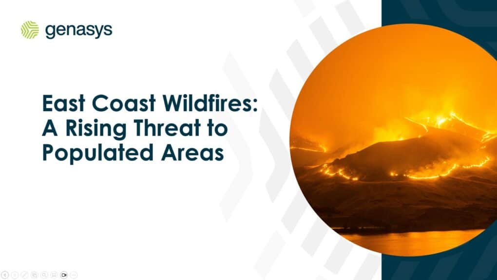
The Wildland Urban Interface is Growing, And So Is the Risk
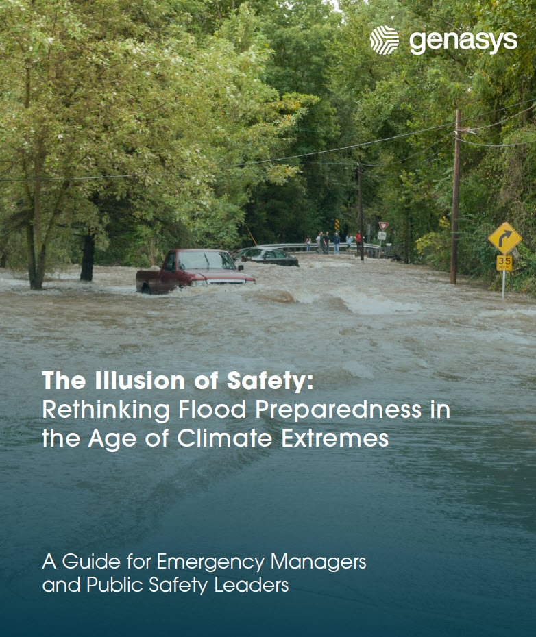
As more people move into the Wildland Urban Interface (WUI)*, the threat to life and property grows. Drought, wind, and fuel buildup are making wildfires faster and more desctructive. Many communities are not equipped to evacuate at necessary speeds.
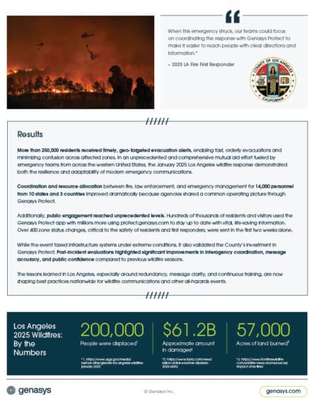
Thousands of fire service, emergency management, and law enforcement agencies rely on Genasys Protect (formerly Zonehaven) act fast, communicate clearly, and keep people safe. Our platform has supported response efforts in major wildfires such as the Dixie, 2025 Los Angeles, SCU Lightning Complex, Glass, and Smith River Complex fires.
Reduce the time to plan and execute evacuations and provide clear communications to partner agencies, the public, and the media.
Make data-driven decisions and communicate quickly to get people out of harm’s way. Protect citizens, visitors, firefighters and first responders.
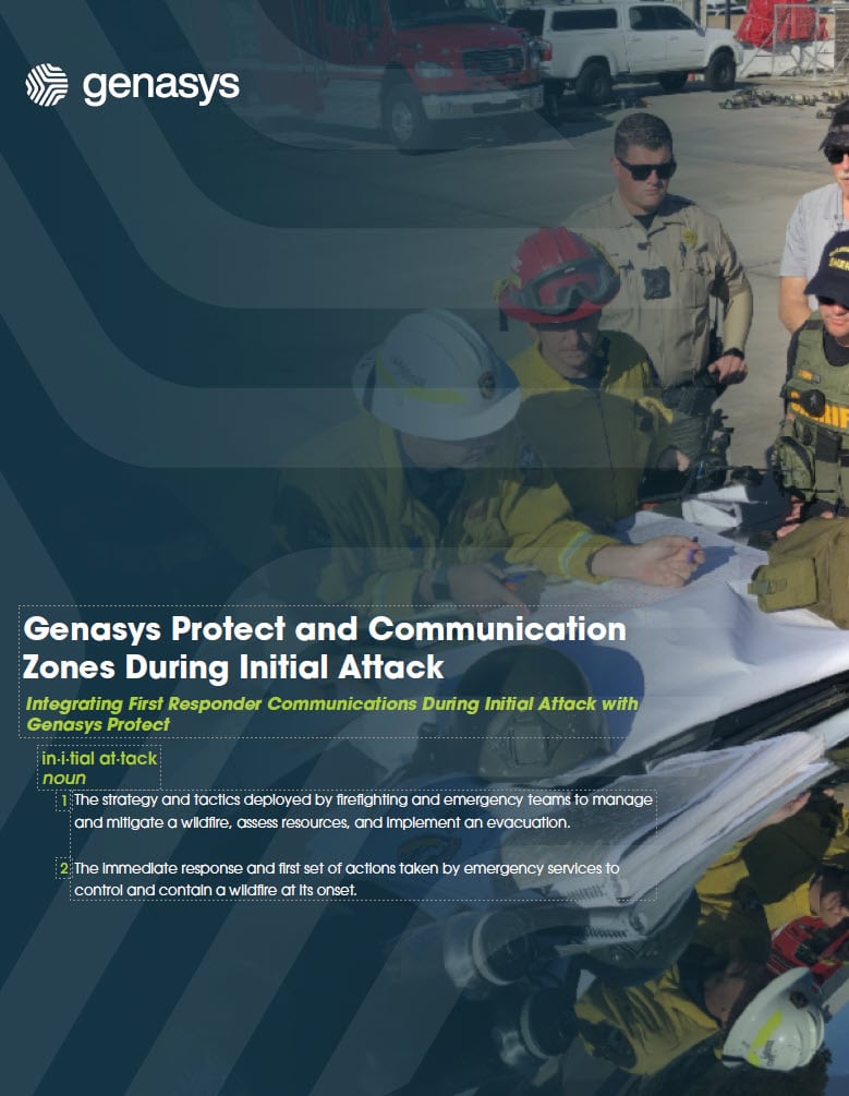
Accelerate response and communications from the initial attack phase and beyond through accessible situational awareness information and collaboration tools.
Work from a common operating picture to create unified responses across multiple agencies, aligning mutual aid and cross-jurisdictional resources to reduce delays and miscommunication.
Communicate consistently with the public during evacuation, recovery, and repopulation phases. Build trust and reduce stress through actionable information that reaches everyone, including vulnerable populations.
Empower citizens with an intuitive self-service app that shares key information. Improve their decision making and reduce call center overloads from the public seeking information.
Broadcast zone-based communications through mass notification using IPAWS, multi-channel alerts, and always-connected Genasys outdoor acoustic devices. Residents and visitors can stay informed with the Genasys Protect mobile app.
Genasys Protect
Real time, zone-based planning and evacuation management
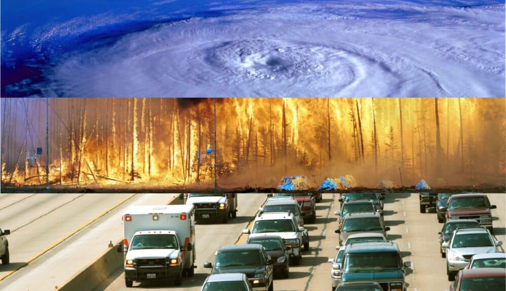
Genasys Protect helps you achieve your Primary Mission: get people out of harm’s way and protect life, from wildfires and flooding to hazardous materials and active shooters.
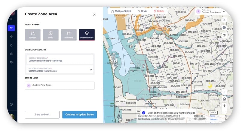
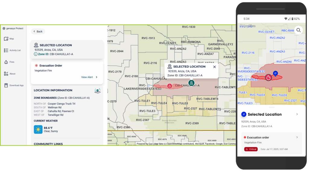
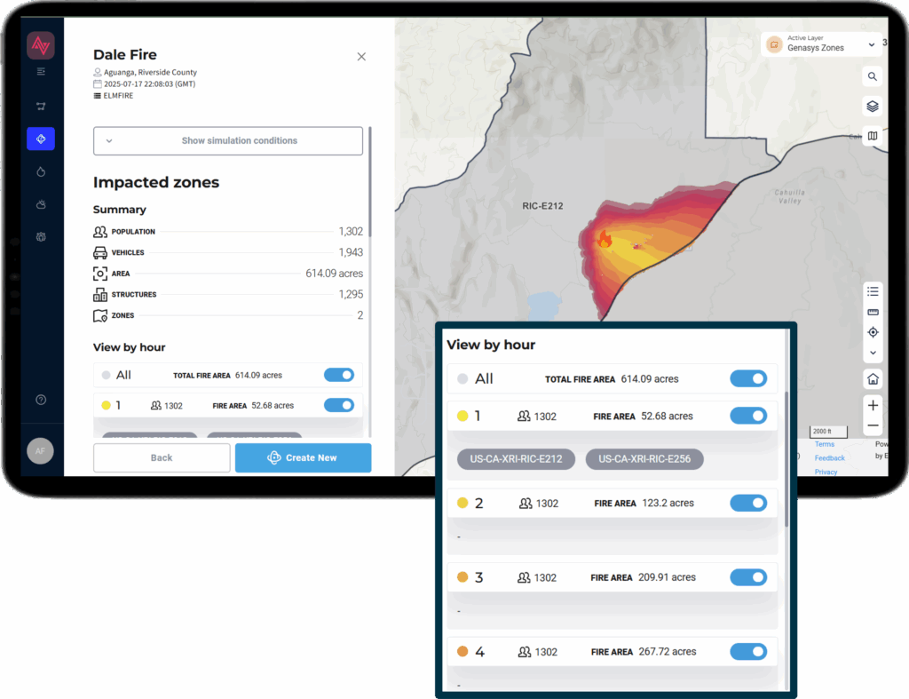
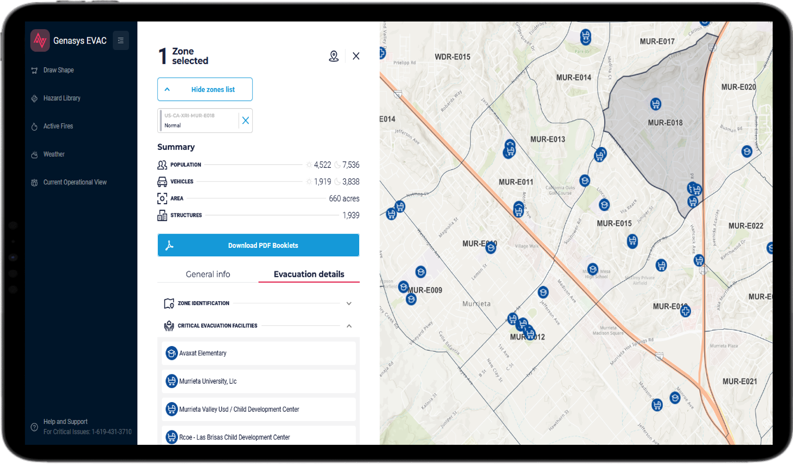
Reduce the time from incident recognition to community notification. Gain an instant snapshot of the crisis you’re dealing with; Keep track of hundreds of zones and what is inside them from population and structure count to traffic congestion and critical infrastructure. Make fast, informed, confident decisions. Have confidence knowing you’ll be ready when it matters with Genasys Protect.
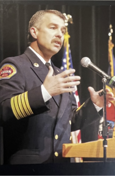
As a first responder and emergency manager, I have lost countless hours of sleep worrying about my own community and wondering if I was doing everything I could to keep them safe. Every fire season I watched as the scale of devastation grew throughout the western United States with each successive wildfire. Every year, wildfire consumed more acreage, destroyed more homes, and took more lives; setting new records for devastation along the way. I came to Genasys, because 40 years ago I dedicated my life to helping others and keeping my community safe. Though I no longer wear the badge, that commitment is unchanged. I believe in the work we are doing, and that Genasys Protect is a game changer and a tool that truly makes communities safer.
Ken Kehmna
Ret. Fire Chief, Santa Clara County
Senior Policy Advisor, Western Fire Chiefs
Genasys Protect enables you to:
Automatically generate smart evacuation zones for easier communication and management of hyperlocal information.
Stay a step ahead during wildfires and enhance planning capabilities through accurate crisis simulation and modeling.
Deploy unified cross-agency responses with a common operating picture and collaboration tools that provide shared situational awareness.
Provide community engagement programs and self-service information portals to increase awareness and engagement.
Communicate with community members and visitors through the Genasys Protect mobile app
Meet the public where they are, whether or not they register
Genasys Protect public mobile app and website
Zone-based mass notification using IPAWS-WEA
WAZE integration
Esri and Tablet Command integration
Social media and Email integration
Outdoor, always-connected speakers to broadcast voice communication with specific actionable information
Key Wildfire Safety Solution Partners