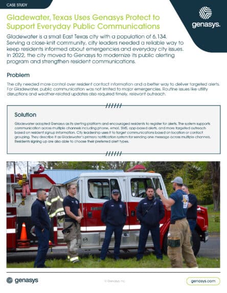


Consolidating Evacuation Communications in Yavapai County, AZ
Yavapai County, Arizona, spans over 8,000 square miles of varied terrain that includes forests, desert, and mountainous regions, including the communities of Prescott, Cottonwood, Clarkdale, Chino Valley, Camp Verde, Jerome, and Prescott Valley. The Yavapai County Office of Emergency Management (YCOEM) negotiates a geographic diversity that increases the complexity of emergency preparedness and response.
The Yavapai County Emergency Management team works with municipal departments, fire districts, and law enforcement agencies across the region, all of whom must be ready to communicate effectively during wildfires, flash floods, and other fast-moving emergencies.
Solution
To address this gap, Yavapai County adopted Genasys Protect, a zone-based evacuation management software designed to improve public safety and emergency preparedness. The platform enables real-time, location-based alerts that ensure residents receive consistent evacuation instructions across all jurisdictions.
Protect allows Yavapai emergency management teams to define evacuation zones, monitor incidents, and activate targeted notifications within agencies and to the public through a citizen’s app. This level of precision is critical in a region as geographically diverse as Yavapai. It ensures the right message reaches the right people at the right time.
Problem
During fast-moving incidents, Yavapai County’s biggest challenge was coordinating evacuation messaging across multiple agencies and jurisdictions in a consistent way.
Each agency relied on its own tools, maps, and communication procedures, which slowed approvals and created gaps in coverage when incidents crossed jurisdictional boundaries.
As a result, residents sometimes received inconsistent instructions or no alert at all, depending on which jurisdiction they were in. Emergency management also lacked a consistent way to target exact areas at risk and confirm that evacuation instructions had reached the right people. This fragmentation increased confusion at the moment clarity mattered most.
Results
Since the adoption of Genasys Protect, Yavapai County emergency management has significantly improved its ability to coordinate multi-agency responses and issue timely evacuation alerts. The zone-based system empowers first responders to make data-based decisions and communicate more effectively with the public.
Yavapai residents now receive geographically relevant notifications that reduce confusion and improve evacuation outcomes.
The YCOEM and Genasys initiated a successful joint evacuation training session offering comprehensive training that further solidified confidence in the system and demonstrated that cross-agency coordination can function smoothly under a unified platform. As a result, Yavapai County has enhanced its emergency preparedness capabilities while setting a precedent for how rural and urban communities can consolidate evacuation communications.
Yavapai County: By the Numbers
252,000 Residents in 2024
8,125 Square miles of land
55+ The median age of residents