


By Tynan Heller, Senior Product Manager, Genasys Inc.
Emergency management is constantly evolving, and Genasys is leading the way. With the latest enhancements to EVAC, emergency managers can now import custom zones and use them directly to send alerts, coordinate response efforts, and manage evacuations in real-time. You can even draw your own custom zone, on-the-fly, for rapid responsiveness to any situation. This innovation transforms how emergency zones are handled, making EVAC an even more powerful tool for all-hazard readiness.
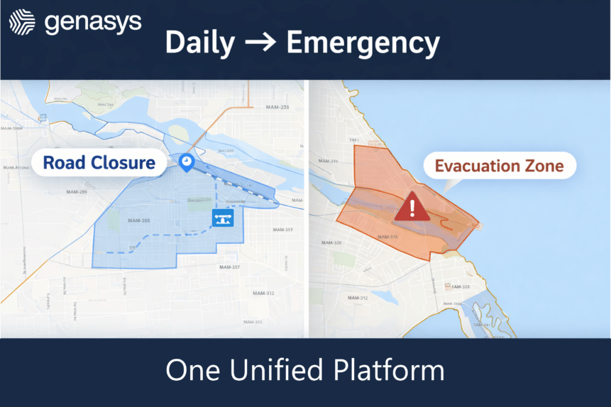
From Standard Overlays to Custom Zones
EVAC has always provided intelligent zones, capable of facilitating access to information, alert sending, and coordination efforts between first responders. Like other emergency solutions, emergency managers could import custom GIS layers as shape files into EVAC. While useful for reference, these GIS layers were just visual overlays, they couldn’t be used for direct action. Now, these GIS layers are fully integrated and functional, making them into custom zones, allowing teams to apply targeted evacuations, shelter-in-place orders, and customized response strategies based on their specific needs.
This enhancement takes zone-based emergency management to the next level. Different disasters require different zones, and a one-size-fits-all approach doesn’t match those unique demands. A wildfire zone may focus on fire spread patterns, while hurricane zones prioritize storm surge and flood risk. With EVAC’s new custom zone capabilities, emergency managers can now adapt dynamically to any hazard.
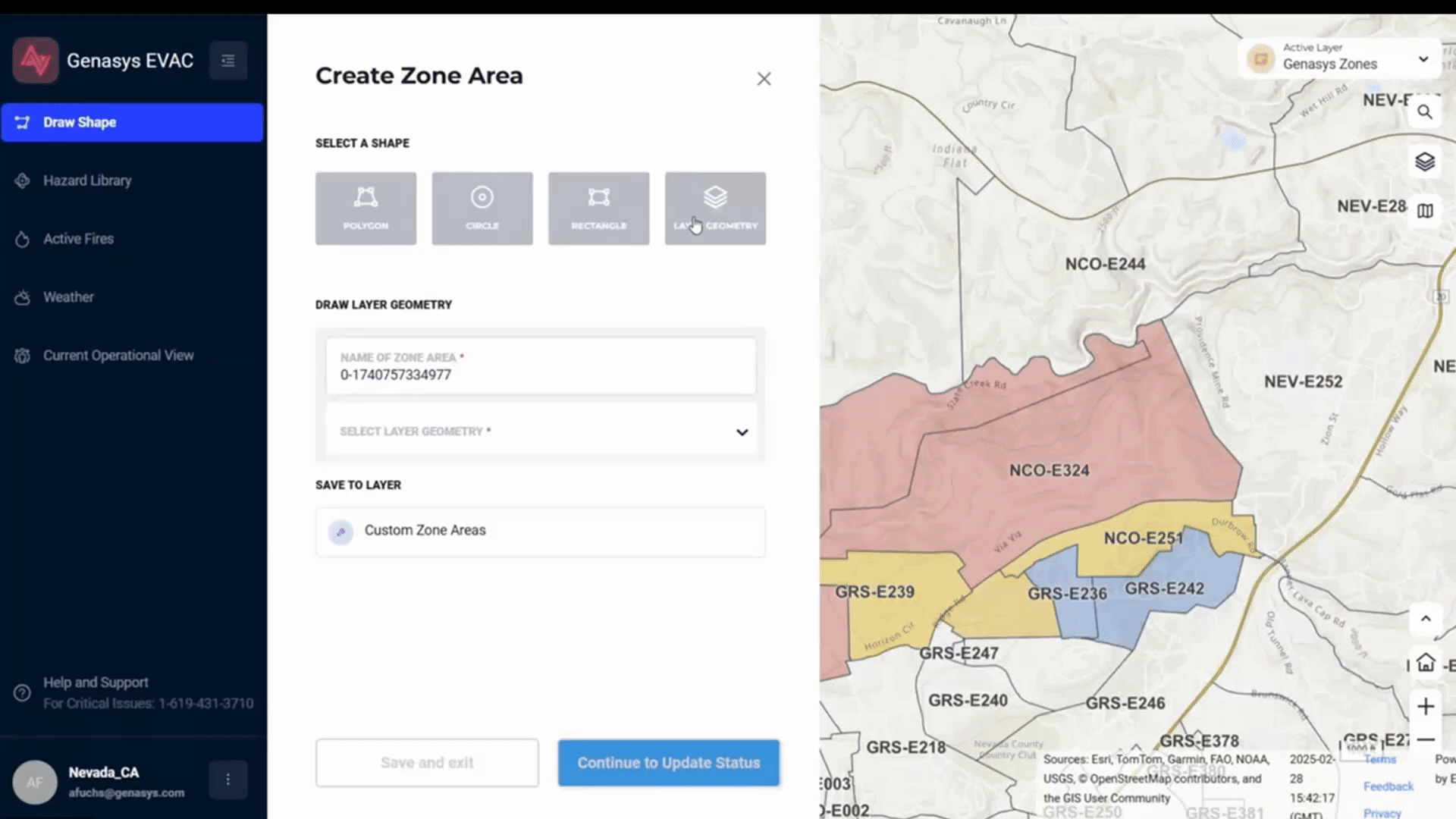
Create and customize zones for any hazard scenario, seamlessly adapting to events from wildfires to floods. Easily switch between active zones to match the situation, whether issuing an evacuation order or a shelter-in-place directive. Transform your GIS layers into functional zones and enhance them with local expertise to fit your region’s needs.
Why This Matters in Real Emergencies
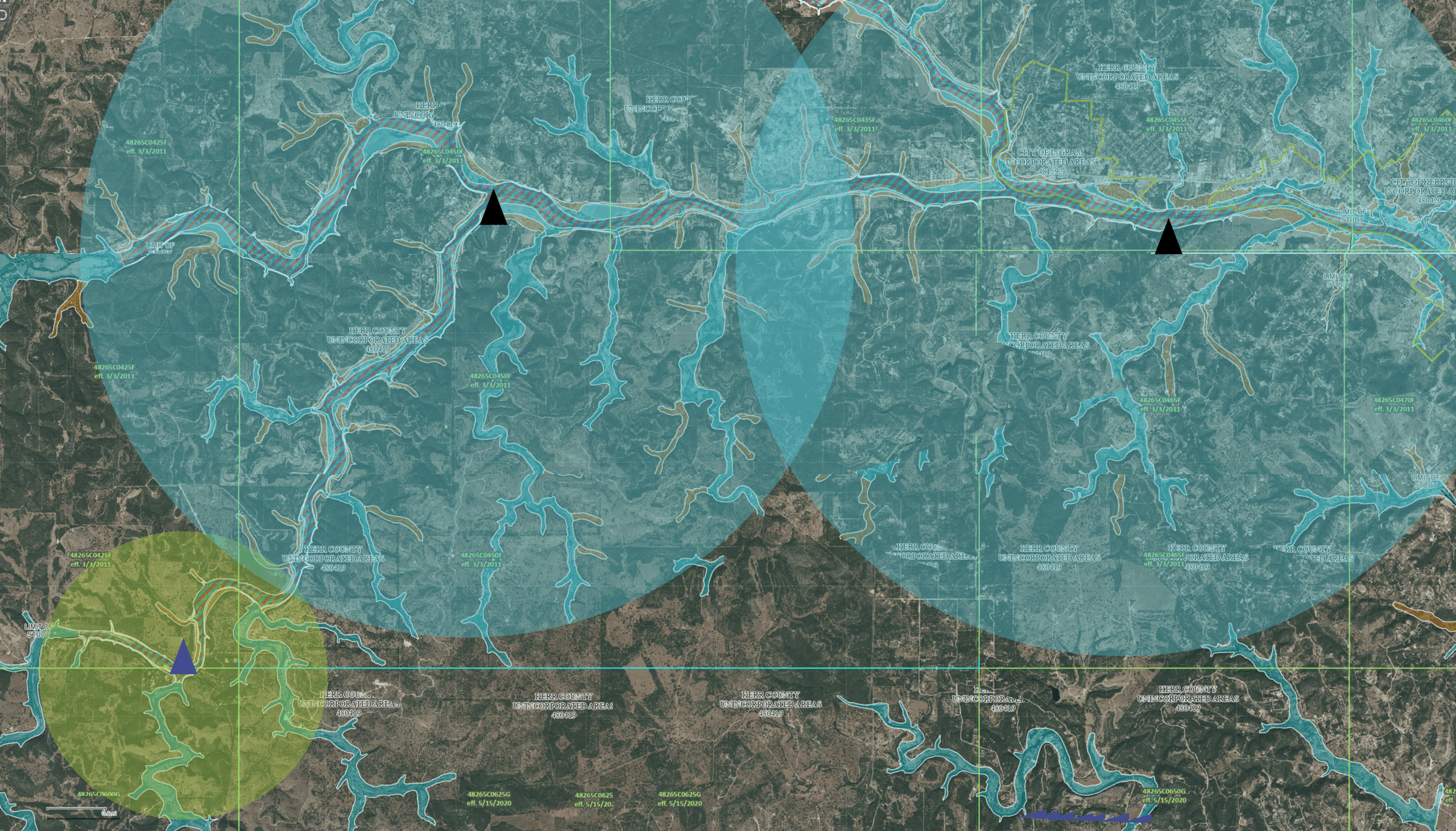
This improvement isn’t just a technical upgrade; it’s a game-changer for emergency response. Different regions face unique disasters, and now you can tailor EVAC to include the most relevant zones built from highly detailed local data collected over years. Additionally, zones linked to Esri GIS data will update automatically to reflect updated real-world conditions.
For example:
- During a hurricane, authorities can instantly activate evacuation zones based on storm surge predictions, ensuring those at risk receive alerts.
- During fire incidents, zone geometry can be updated based on evolution of the fire and mitigation efforts.
- In flood-prone areas, officials can send alerts only to residents in at-risk flood zones, based on real-time data, avoiding unnecessary panic and keeping roads clear for those who need to leave.
By integrating custom, functional zones, EVAC reduces confusion, improves coordination, and enhances public safety.
A True Differentiator in Emergency Management
Genasys is redefining emergency response with intelligent, adaptable zoning. Going beyond static, pre-set zones, EVAC lets you use your custom GIS layers to make your data work for any hazard or emergency.
With this breakthrough, Genasys continues to push the boundaries of emergency management technology. EVAC isn’t just a tool, it’s part of the evolving Genasys Protect platform designed to meet the real-world challenges of first responders and emergency managers. When every second counts, having the right zones in place makes all the difference.
Interested in learning more about these product updates or more about Genasys Protect and LRAD? Watch the recorded webinar of the updates and reach out, today!